About Mapitare Terrain and Sea Map
MAPITARE TERRAIN AND SEA MAP Now you can try all the maps free for seven days ((c)Sjöfartsverket three days)! Mapping software downloaded into your mobile phone’s memory improves your safety when outdoors!
MAPITARE TERRAIN AND SEA MAP
Now you can try all the maps free for seven days (©Sjöfartsverket three days)!
Mapping software downloaded into your mobile phone’s memory improves your safety when outdoors!
Mapitare is the first offline mapping software on the market that can be downloaded at once and is designed for critical work and demanding conditions on land, water and air.
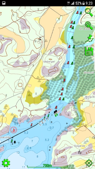
The Mapitare terrain and sea mapping software is useful for outdoor enthusiasts, hikers, hunters, boaters and anyone who spends time outdoors. The digital map displays real-time location on a map. The risk of getting lost in mountainous terrain is the greatest when visibility weakens, and even an experienced hiker can lose his or her sense of direction on easy forested land. A ball indicating your position on the map will guide you back to the right path. The map on your phone screen is especially useful in bad weather, when the risk of getting lost is the greatest.
The unique Mapitare terrain and sea map does not require a telephone or electricity networks to function. All of the map data has been downloaded into the memory of the phone. Offline maps are suitable for critical work and function quickly and precisely in all conditions and everywhere within the map’s area. Therefore, weak telephone and data connections do not have any effect on the use of the Mapitare map. They can be used even after the telephone network has already faded. The operator is responsible for ensuring adequate battery life, and if necessary, should back it up with a power bank or backup battery.
In its entirety the data covers all of the land and sea areas of Finland, Sweden and Norway. In future the map data will expand even further:
National Survey
©Maanmittauslaitos, CC BY 4.0 (19,99€/year)
©Lantmäteriet, CC BY 4.0 (19,99€/year)
©Kartverket, CC BY 4.0 (19,99€/year)
Road Management
©Liikennevirasto, CC BY 4.0
©Trafikverket, CC BY 4.0
©Kartverket, CC BY 4.0
Addresses
©Väestörekisterikeskus, CC BY 4.0
©Trafikverket, CC BY 4.0
©Kartverket, CC BY 4.0
Cadastral Registry (property)
©Finnish National Survey, CC BY 4.0
Land parcel register
©Agency for Rural Affairs, CC BY 4.0
OpenStreetMap
©OpenStreetMap contributors
©Creative Commons, CC BY-SA
Other data
©National Forestry
©SYKE
©LIPAS
Maritime Administration (requires terrain map)
©Liikenneviraston lisenssi No. 1604/07/07.03.01/2015 (9,99€/year)
©Sjöfartsverket licence No. 17-00494 (29,99€/year)
Make groups and follow friends on the map 4.99€/month (Android)
Mapitare Ltd
The company has over 15 years of experience in operational systems. As a result of the five years of development, a new mapping technology and reliable service model (tested) have been created. The map has no scale limit, and items are presented with production precision (cm).
Mapitare software has no dependencies on other suppliers. As a result, 100% change management can be done in a cost-effective way. The software products can be used in all systems and network connections are not needed for their use. Being independent of the environment and hardware guarantees a long life cycle for the technology.
Mapitare’s services:
Mapping services
Communication and positioning services
Mapping technology and interface services
Operational situational awareness and management systems
Previous Versions
Here you can find the changelog of Mapitare Terrain and Sea Map since it was posted on our website on 2020-07-16 03:13:35.
The latest version is 1.3.74 and it was updated on 2024-04-22 11:46:42. See below the changes in each version.
Mapitare Terrain and Sea Map version 1.3.74
Updated At: 2024-03-30
Changes: - parannettua tukea vanhoille android versioille
- korjattu virheitä
Mapitare Terrain and Sea Map version 1.3.73
Updated At: 2024-03-14
Changes: -Error corrections
Mapitare Terrain and Sea Map version 1.3.71
Updated At: 2023-12-06
Changes: -Maps updated
-Error corrections
Mapitare Terrain and Sea Map version 1.2.64
Updated At: 2023-05-11
Changes: -Orthophotos of Finland
-Error corrections
Mapitare Terrain and Sea Map version 1.1.51
Updated At: 2021-03-30
Disclaimer
Official Google Play Link
We do not host Mapitare Terrain and Sea Map on our servers. We did not scan it for viruses, adware, spyware or other type of malware. This app is hosted by Google and passed their terms and conditions to be listed there. We recommend caution when installing it.
The Google Play link for Mapitare Terrain and Sea Map is provided to you by apps112.com without any warranties, representations or guarantees of any kind, so access it at your own risk.
If you have questions regarding this particular app contact the publisher directly. For questions about the functionalities of apps112.com contact us.